Welcome to the Ilucidare Playground
Flanders Heritage Agency is a government agency and scientific institution responsible for architectural, archaeological, landscape and maritime heritage. Today we're taking part in the Ilucidare Playground: Cracking the future of heritage. We bring new technologies and paradigms together with our responsibility for heritage, to improve preservation, support decision-making and management, and inform the public. Here are a few concrete results of that innovation-driven approach.
No innovation without dissemination
Innovation often brings technology to mind, but society itself is innovating constantly too — sometimes driving technological progress, sometimes following it. One of the past decade's clearest shifts has been toward openness: open source software, open data and open access are central to today's information-driven society. Both Flanders Heritage and the Flemish Government support open data and open access. On the open data side, the government has adopted the Smart Flanders Open Data Charter; Flanders Heritage has published several open datasets, such as our thesauri and controlled vocabularies, under the Flemish open data licence, and we also publish the software used to maintain them as open source.
On scholarly open access, we aim to make all our publications freely available. Nearly all research output is published through OAR, our Open Access Repository. In recent years we've invested in digitising publications by our predecessors, and now have an online archive going back to the eighties, all freely downloadable. Digitisation might sound trivial — scan it, put it online — but copyright and the effort of producing good metadata make it more work than it looks. It's paid off: since digitising and publishing our back catalogue, monthly downloads have doubled, and we now see around 15,000 publications consulted digitally every month.
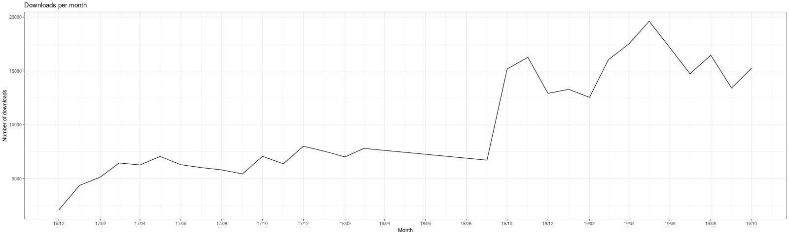
Number of downloads per month from OAR
Pictures or it didn't happen
While our publications are still very much a written information channel, visual information matters more and more today. Heritage professionals have documented heritage and its condition ever since cameras existed, and digital cameras — more recently smartphones with good cameras — have only accelerated this. We estimate a few million pictures circulate within our agency, in both analog and digital form. In 2019 we launched a new online image database holding some 280,000 images of heritage in Flanders, some recent, some digitised from analog archive material. Reusability mattered a lot here too: where possible, images are published under an open licence allowing reuse, even commercially, as long as attribution is given.
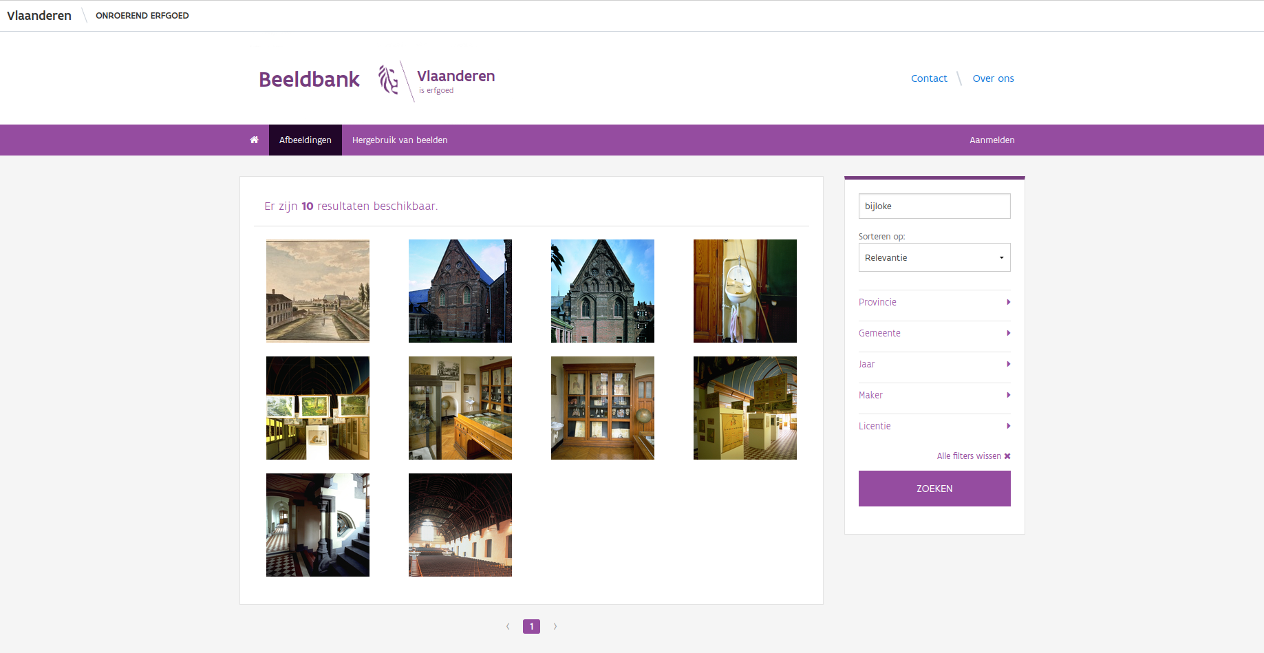
A set of images in the image database found by searching for "Bijloke"
The system has been running for a while and has proven our basic needs are covered, so we're now tackling more complex problems. First, GDPR and privacy: while our pictures are taken in public places, things like license plates and faces count as sensitive data. We have manual review procedures, but they're slow and labour-intensive, so we're exploring automatic detection and blurring of license plates and faces with OpenCV. Results for license plates have been good; results for faces more mixed, likely because license plates follow a simple, predictable format, while facial detection tends to be a bit too eager — it has a habit of flagging paintings, sculptures or billboards as faces too. More tuning is needed before this is ready for large-scale use.
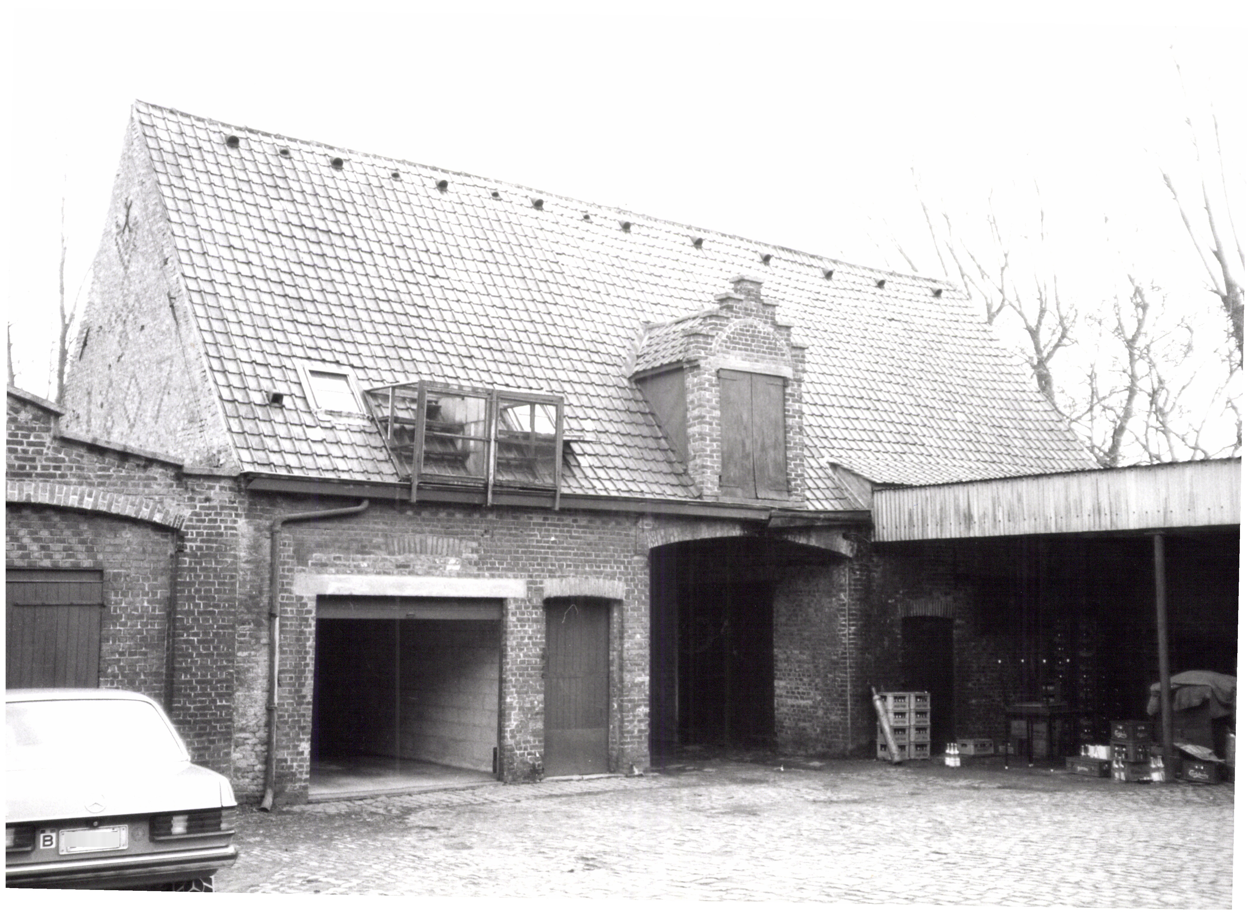
The license plate on the left was automatically blurred with OpenCV
Another avenue is automated duplicate detection. As in any large organisation, files get copied, distributed and emailed repeatedly, and images end up in multiple places — costing storage and, since every image needs metadata, duplicating that effort too. We're exploring automatic duplicate detection; image hashing looks promising, and we'll likely settle on the dHash algorithm. We're now working out how to integrate this properly into our archiving workflows so colleagues benefit without needing to deal with the technical details — innovation only really pays off once it comes with usability.
As a government agency dealing with immovable cultural heritage, almost everything we collect has a spatial dimension, and our images are no exception. Nearly every picture we take shows some form of immovable heritage — an archaeological site, a cultural landscape, a building, a cemetery, or something else — so we've put real effort into geolocating the images in our database. Older images are linked to the heritage objects they depict and inherit their location; newer images rely on the automatic geolocation built into modern smartphones and cameras. The resulting GIS layer of point locations can be visualised on our geoportal or downloaded for your own use, and every picture links through to the image database for more information, download and reuse — provided you respect the licence.
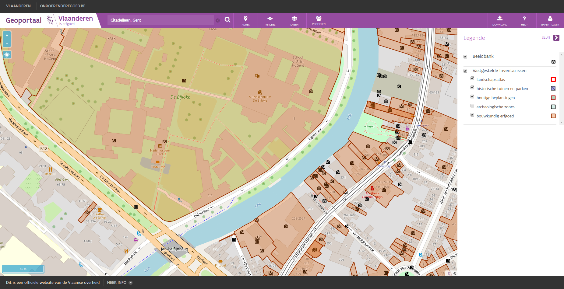
A view of the Bijloke site in Ghent with all known images of this area
Give me a map and I'll never get lost
Nearly everything we do has a spatial component, which makes maps essential to us. As a government agency we publish INSPIRE-compliant datasets, distributed through the INSPIRE network across Europe — aimed mostly at professional GIS users on their own desktop software. But we felt we were missing part of our audience: people who just want to quickly find out what's known about their neighbourhood, their property, or a place they remember from childhood. That's why we built our own Geoportal, a website where a regular, non-GIS user can browse a (hopefully) intuitive map of Flanders and see what heritage is present — the aim was something like "Google Maps for Heritage." It's no longer new, but it's still very popular, and because it's optimised for heritage data specifically, it works better for that purpose than a general-purpose portal. For general spatial data we point people to Geopunt, the Flemish Government's geoportal for all spatial data — it holds far more data than we need, but isn't optimised for heritage information specifically.
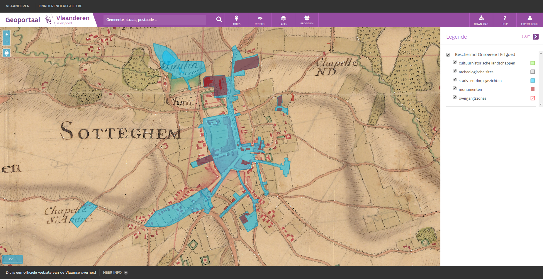
The current-day city of Zottegem and its listed heritage as seen on the Villaret map (1745-1748)
First-time visitors to the Geoportal are asked to pick one of two profiles — preset combinations of map layers, one a good default for most people, the other tuned for users focused on the legal side of heritage (actuaries, real-estate agents, property developers, other government bodies, and so on). You can always load other layers too. Some point to our other systems, like the image database mentioned above, or archaeological survey reports submitted by archaeologists. Base layers include several orthophoto layers as well as historical maps, some dating back to the 18th and 19th centuries — some supplied by Informatie Vlaanderen, others, like the Villaret map (1745–1748), digitised by us in cooperation with them.
Have a look at our portal, browse the map, and dig into the places and pictures you find there.
When points become clouds of information
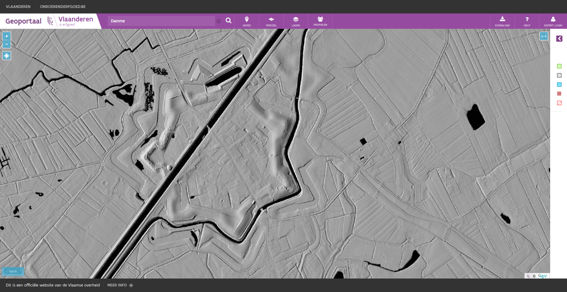
The city of Damme and its fortifications as seen on the multidirectional hillshade
One last mapping project to close with. Our colleagues at Informatie Vlaanderen created the Digitaal Hoogtemodel Vlaanderen (DHMV), a LIDAR dataset consisting of a Digital Surface Model and a Digital Terrain Model, together giving height data that lets us visualise the Flemish terrain in different ways. While the raw data is open, turning it into a useful visualisation takes real expertise, so a few standard renderings have been available for a while. We knew it was possible to create visualisations better suited to archaeologists, allowing easier detection of archaeological sites through micro-topology, so Flanders Heritage and Informatie Vlaanderen collaborated on two new renderings of the DHMV and published them. Each uses different techniques and parameters, so which one helps depends on what you're looking for.
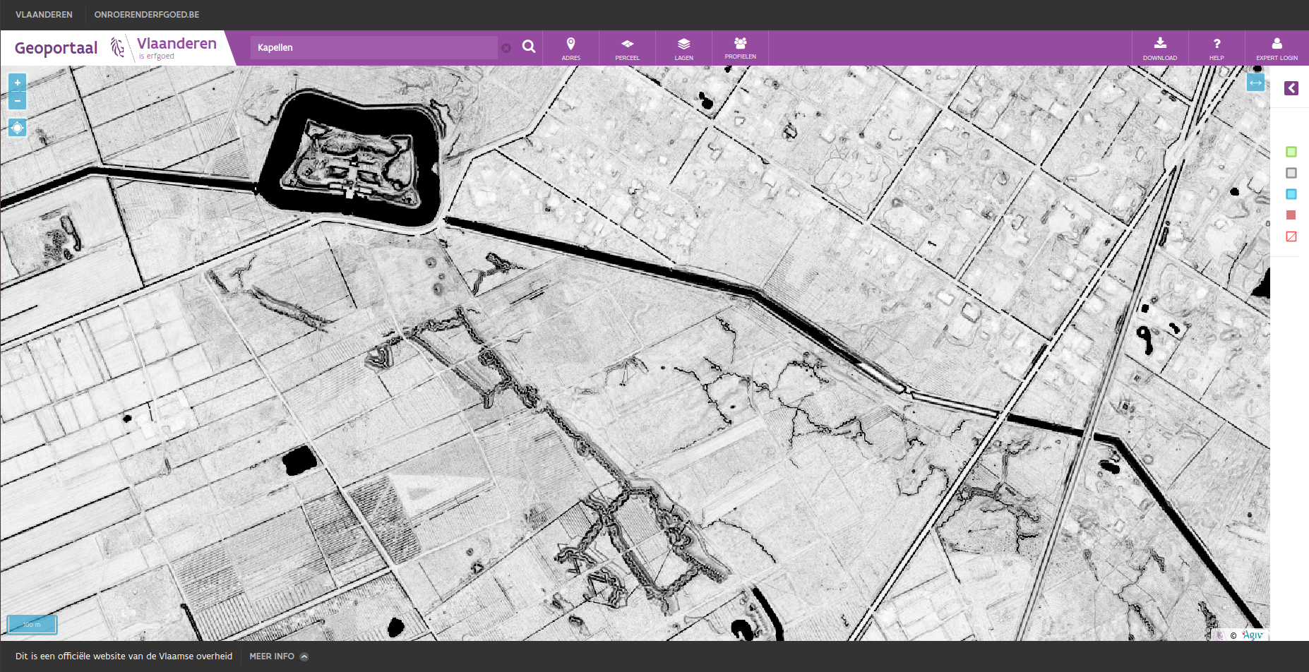
Trenches and a fortress near Kapellen as seen on the skyview factor
The result has proven genuinely useful to archaeologists in their day-to-day work — glancing at these two layers, either on the Geoportal or downloaded into their own GIS, lets them quickly judge the potential of a site or location. To try it, head to the Geoportal and select them under Layers > Background layers > Digital Elevation Model > DHMV II, multidirectional hillshade or DHMV II, skyview factor. This project has been more successful than we expected, and its impact has reached well beyond archaeology and cultural heritage — it was even nominated for a Datanews ICT Project of the Year and an Agoria e-Gov Award Open Data.
We hope this shows there's a real synergy between heritage and technology as we move further into the 21st century. Like every organisation, technology has become deeply woven into our daily operations. As Satya Nadella, Microsoft's CEO, put it: "Every company is now a software company" — and the same holds for a government agency or a cultural heritage institution. Software is everywhere, digital is everywhere, and even though our cultural heritage is still largely analog, the tools and information sources we use to study it no longer are, and never will be again.
Questions? Get in touch, browse the rest of this blog, check out our open source projects, or visit our website.